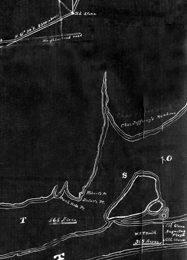
All the references I had found to date regarding this property either mentioned one name or the other. So rational minded guy that I am, thought perhaps some of the owners eg the Robert bunch, called it "Robert's Point" and others like the Laniers called it "Doctor's Point" for Doc Robert who was the first guy on the deed, And my silly conclusion ..... therefore it must be one and the same place ....
No sooner had I put that into print and an envelope shows up at my house from Mallory Leoniak at the Brookhaven Town Historans office. When Mallory finds something for me (Like the Charles Stevens photo of The Knapp Mansion in The Tablet) it's usually a dilly. This copy of a map she sent must of been commisioned by the Smith Brothers & Sisters around the turn of the 19th century. All the land they were about to divy up and sell off is neatly marked out including whats under the water. The map is titled "Manor of St. George ( Furman ? )" it could later be called Clarence got his and I got mine....It extends from Carmens River to past Moriches. I will be posting the rest of it in appropiate places in time to come but for now this small piece of it answers the age old question .........