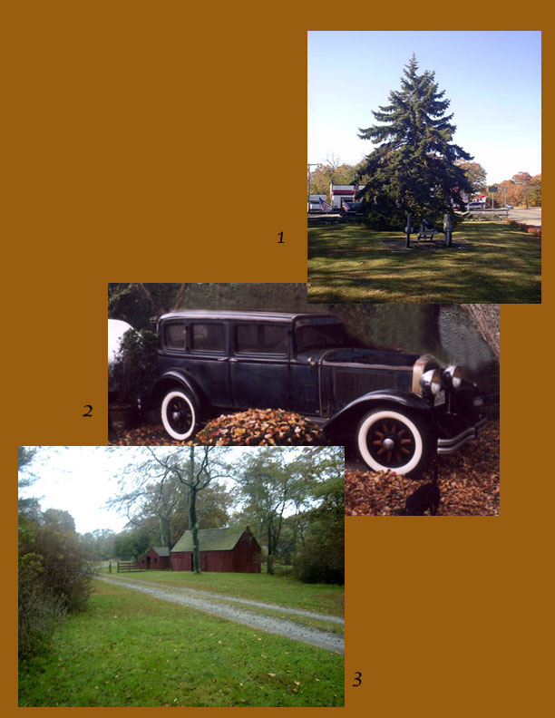
 1. At the west entrance to Mastic Beach,
where Commack & Neighborhood Roads cross in a distinct X
, the Chamber Of Commerce now calls it "The Town Square".
Not one to rock their boat, I've cropped off the point that was
in the foreground to comply. Although I never was much for math,
I would have to say it's still very much a triangle. I'm sure
every gas station owner that ever did business there since the
1940's would back me up especially the guys who ran it as "Triangle
Shell". During the bi centenial they rolled in an old cannon
and planted a nice pine tree to spruce it up!
2. I've said it before and I'll say
it again. I could not do these trips without the assistance of
Kenny "Tangier" Vitellaro, who always provides me with
a place to stay and stellar transportation! This time was no different.
That's his new 1930 Buick parked in his Shirley driveway. Let's
take it down the road!
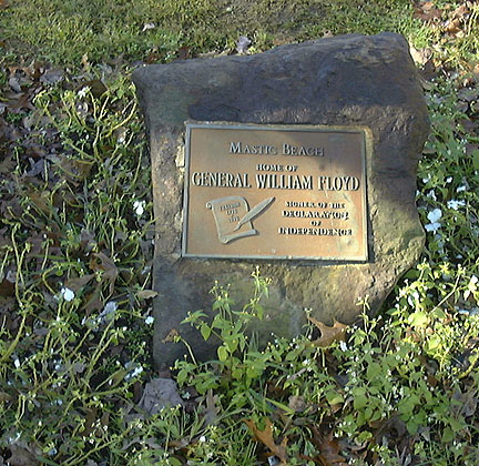
3. The William Floyd Estate was where
my interest in all this started back in 1951. I was around five
years old on my first visit and it's barns were the first buildings
I saw there. I wrote about that trip in a short story called Mansions
Of The Mastics that's on the website. This time up I visited twice.
Kenny & I just walked the grounds one Sunday afternoon and
then I came back to research the Floyd Archives with the able
assistence of Steve Czarneiki of the National Park Service.
MASTIC NECK FROM THE WEST COAST TO
THE EAST
By Land & By Sea
1. At the west entrance to Mastic Beach,
where Commack & Neighborhood Roads cross in a distinct X
, the Chamber Of Commerce now calls it "The Town Square".
Not one to rock their boat, I've cropped off the point that was
in the foreground to comply. Although I never was much for math,
I would have to say it's still very much a triangle. I'm sure
every gas station owner that ever did business there since the
1940's would back me up especially the guys who ran it as "Triangle
Shell". During the bi centenial they rolled in an old cannon
and planted a nice pine tree to spruce it up!
2. I've said it before and I'll say
it again. I could not do these trips without the assistance of
Kenny "Tangier" Vitellaro, who always provides me with
a place to stay and stellar transportation! This time was no different.
That's his new 1930 Buick parked in his Shirley driveway. Let's
take it down the road!
3. The William Floyd Estate was where
my interest in all this started back in 1951. I was around five
years old on my first visit and it's barns were the first buildings
I saw there. I wrote about that trip in a short story called Mansions
Of The Mastics that's on the website. This time up I visited twice.
Kenny & I just walked the grounds one Sunday afternoon and
then I came back to research the Floyd Archives with the able
assistence of Steve Czarneiki of the National Park Service.
MASTIC NECK FROM THE WEST COAST TO
THE EAST
By Land & By Sea
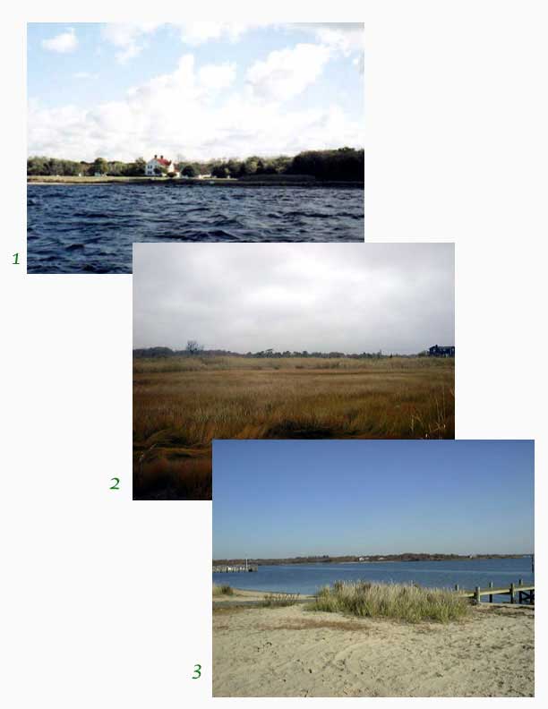 1. The Manor Of St. George as seen
from the mouth of Carmen's River.
2. A rainy day on the marshlands at
the end of Jefferson Drive.
3. Osprey Park at Floyd Point looking
across the mouth of Forge River to Masury Point.
NEXT
1. The Manor Of St. George as seen
from the mouth of Carmen's River.
2. A rainy day on the marshlands at
the end of Jefferson Drive.
3. Osprey Park at Floyd Point looking
across the mouth of Forge River to Masury Point.
NEXT
THE BIG APPLE